Monday, April 20, 2020

Darwin – Heart of Crocodile Country


But first – March 11 and 12

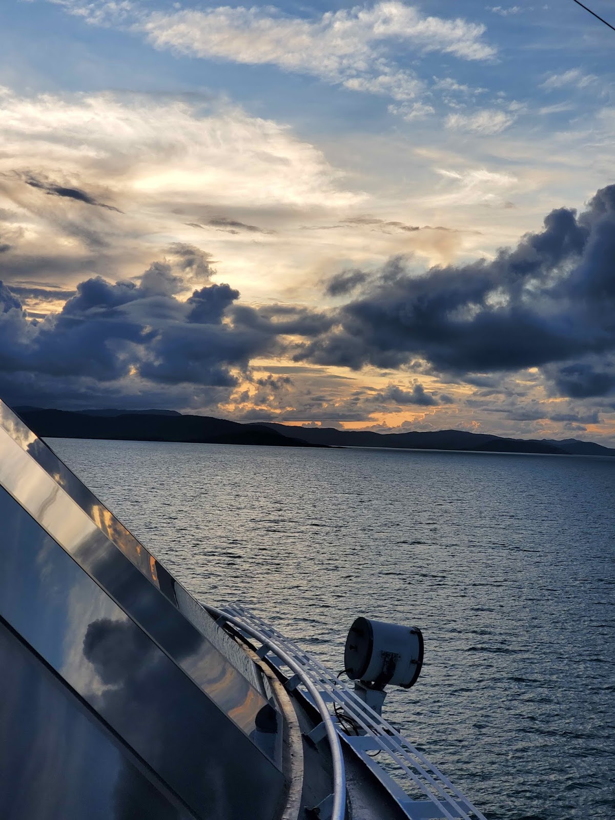
Our sea days after Cairns should have given us some lovely views of the islands on the far north part of the reef on the first day, but of course the weather didn’t cooperate. Instead we had a gray, rainy day with a few breaks. Here are a couple of photos:


It would have looked much nicer in bright sunshine….oh, well; we’ll have to try again another time.

March 13

Here we are again with the lazy Aussie pronunciations….the locals sort of leave out the ‘r’ in Darwin, pronouncing it more like Dahhhhwin. Wonder what Charles Darwin would have thought. Even though he never came to Australia, and he probably would have loved to investigate the wildlife given the isolation of the area, the original harbour was named after him. A surveyor on the MS Beagle who had been in the crew during Darwin’s journey and had been very impressed with his work named the harbour after him when the Beagle found it in 1839. Just a couple of tidbits for you.

One of the few days where we had planned different tours, but the only one that actually happened. Darwin had been a military base and fuel depot during World War II, and because of its significance to the area had also been heavily bombed by the Japanese. There are still remnants of wartime history around the city, so Larry took the related tour.

Monica did the more touristy thing – went to see the ‘Jumping Crocodiles’. The whole north coast of Australia seems to be the favoured grounds of the Saltwater Crocodile, one of the holdouts of the dinosaur era. These crocs are extremely dangerous and strong – and stealthy – so there are warnings up on every beach to deter people from swimming. Funny thing is that about 40 years ago, they had been hunted almost to extinction just because they were dangerous to humans. When the hunters realized that there were very few left and that it could affect the whole ecosystem if they died out, they banded together and approached the government to have the Saltwater Crocodile declared an endangered species. It has been so ever since, and the numbers are climbing again.

We (that is Monica and the group) met the crocodiles in the Adelaide River, which does NOT run all the way to Adelaide. That city is on the south coast, about as far away from Darwin as one could get in a relatively straight line. It was called the Adelaide River in honour of Queen Adelaide, wife of the English king, William IV. Surprising no one, Adelaide was in fact also named after her.


To get back to the crocs: we climbed aboard our tour boat and were told to UNDER NO CIRCUMSTANCES put our arms or legs beyond the edges of the boat. Crocodiles have very good eyesight, and would see that as easy pickings. Best let the naturalists onboard take care of handing out the snacks.

The river is fairly wide with a good current, with a tidal swing is about 3 meters that makes navigation a little tricky at times. The crocs don’t have any trouble dealing with this, but the boats have to do a lot of maneuvering to stay in one place.


All of the crocodiles that the naturalists visit on these tours have names. The males have their territories along the river, and will attack and kill any male that invades that territory. They’ve been there for so long that we were given their recent histories if there was something interesting about them.

The first croc we visited was named Knuckles, and he gave us a nice display of ‘jumping’.


See how close we were to those exceptionally
strong jaws???


The naturalists impressed upon us that even though they attract the crocs with food, the small amount of chicken that they get is just enough to replace the energy they use in jumping after it, so their regular eating patterns are not being disrupted and they still hunt for all of their normal food. In fact, a couple of crocs didn’t even make an appearance, probably because they weren’t hungry enough to bother.

We did see, from a distance, a white croc named Pearl. She’s not albino, but her skin doesn’t have the same amount of pigment that the others do. Because she’s so obvious, she has to hide out more than others, so Monica could only get this picture:


We did find another couple of crocodiles willing to jump for a snack. This one is called Casanova:


We also saw trees full of fruit bats – they must be quite large up close, given their size from the boat, but nobody wanted to find out:


…and we had Kites, a relative of the hawk, following the boat for a distance on the way back.

Once we left the Jumping Crocodiles, our tour continued into the Wetlands. This part of Australia is very flat and gets a lot of rain in the rainy season, considering how close it is to Indonesia and the areas that suffer under monsoons every year. We drove up to the top of a hill, the highest point for miles, where the Window on the Wetlands Visitor Centre is located. From there, we had a good view of the extent of the lands that get flooded almost every year. There was no time to stop, as we were headed to the Fogg Dam Conservation Area for a demonstration of some aboriginal traditions.

Much of the Wetlands looks like this in the rainy season. Our
guide said he and his friends used to walk through here
looking for certain plants.....

....maybe there weren't so many of these guys around
then. This is a Freshwater Crocodile, much
smaller than his Saltwater cousins.
As part of the demo on basket and net making, using grasses and reeds, we were all given a couple of leaf pieces to try to pull the fibre out and then roll it. Most of us were not too successful. We did notice that the method used here is almost exactly the same as what we were shown in Rotorua when we toured through the Maori artisan studios: hold a couple of the thin fibres together, roll them down your bare thigh under your palm, roll back up, and then down once more. It makes a very strong rope; come to think of it, fibres are twisted in much the same way by machine nowadays to spin and create yarn.

A demonstration of how to make the rope that was used
to create baskets, nets and bags that were
used to collect food and fish.
Then we were given the demonstration of the didgeridoo. It is much more complicated that you might think. The small tree that is used to make an instrument is not hollowed out after it has been cut down. How would you get to the middle? No, the tree is earmarked, and then the termites are left to do their work, cleaning out the centre over what could be a few years. After the tree is cut down, it soaks under water for 4-5 weeks to rid it of the termites, and then it can be fashioned into the instrument and decorated. Quite a complicated process, and the sounds that a good musician can make are much more varied than the droning 'boing-boing-boing' of the buskers at Circular Quay in Sydney.

This fellow explained the very long process of
making a didgeridoo and what a young man goes through to
learn how to play it properly. Then he played
this one for us.

Back on the ship in the mid-afternoon, we started to organize our packing, as we only had two more port stops on this truncated World Cruise and seven suitcases to pack. And after that, back to our favourite sail-out spot on the ship at the Sunset Bar:


Another day at sea and, almost at the end, we would be in the first port not on the original itinerary – Broome.


Thursday, April 16, 2020

Cairns, or is that Cans, or Kee-an-s???


March 10

Here we are once again in probably the most mispronounced city in all of Australia – and that takes some doing! Most of us would say Caerns, you know, say it the way it looks, but somehow the Aussies seem to lose interest in saying ‘r’s the later in a word that they appear. So the easiest way to make like an Australian and pronounce it right is to say ‘Caaaans’.

Now that today’s diction lesson is over, we can get into our visit. We’ve been here twice in the last five years, so we were wondering just what we would do for the day. In talking to a few of our friends on board, we decided to take the Kuranda Scenic Railway to the town of Kuranda and the SkyRail gondola ride back.

The day started out nice enough as we sailed into port, beyond the marina and right past the passenger terminal! Huh? We did finally land at a wharf in the commercial area, and found out that the passenger terminal is under construction/renovation. And then we waited for the ship to be cleared, a process that seemed endless because of the coronavirus precautions the port authorities were taking. It was pointed out later that in fact Cairns is closer to Papua New Guinea than it is to much of the rest of Australia, being up on the Cape York Peninsula, and there is a legitimate concern over health issues coming into the area from outside.

We were finally allowed out on our tours, but we had to go without our regular tour escorts and their ID ‘paddles’, as no crew or staff were being allowed off the ship. There were 30 of us on our tour; we hoped that everyone would stay together without our ‘cat-herder’ bringing up the rear, as there would be a lot of splitting up the group during the day….

We headed out to the Kuranda Scenic Railway by bus, and arrived at Freshwater Station a few minutes before the train. Here we were already concerned, as there were multiple tours from the ship taking the train and not everyone was in the same class of railcar. That did work out in the end, and we had a nice trip up to Kuranda, although we could see the clouds building as we rode along.

Clouds started to build as we rode past sugar cane fields.

The locomotives are painted with dreamtime symbols
from legends of the local aboriginals, the Tjapukai

Inside the first class car with Renee and Kathy and
the rest of our tour group


The Stoney Creek Falls, bridge and the last of the train's coaches

Construction on the Kuranda Railway started in 1887 to bring miners from Cairns to the gold fields in the Tablelands beyond the town of Kuranda. There was no stable supply route to bring supplies to the small communities, and the wet seasons would usually wash out the roads. The railway was something of a feat of construction, with 14 tunnels and a number of impressive bridges. And it has stories by the hundreds. There were even hotels along the rail line – goodness only knows where, since most of the time we were looking at either a sheer rock face on one side or a slope on the other – for the workers’ time off, and of course no tale of brawn and bravery is complete without a few larger-than-life characters. The commentary as we rode along was really informative and interesting.

Barron Falls view #1

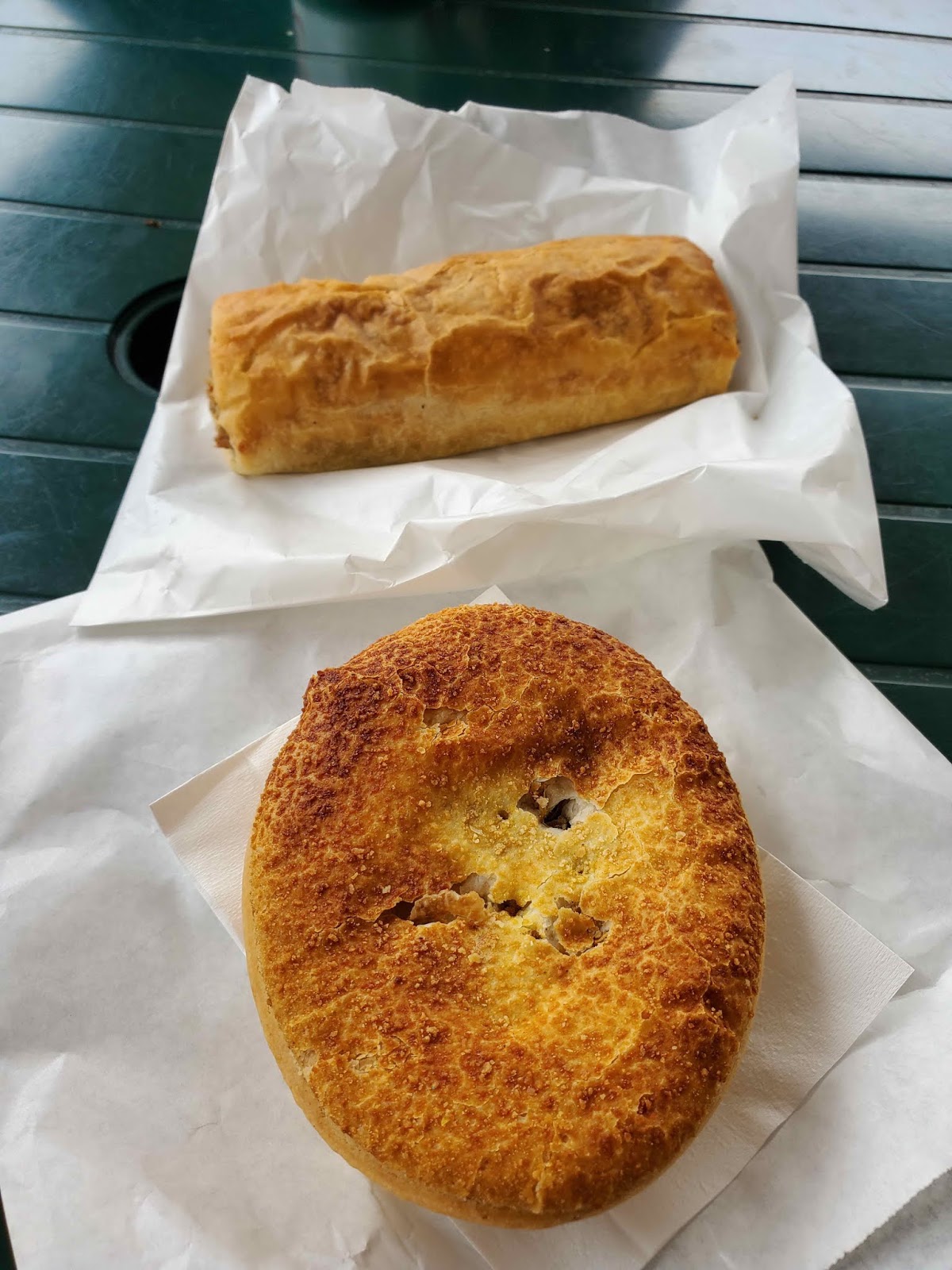
Once in Kuranda, we had some time to wander around the small town, visit some of the attractions, that included a Butterfly Farm and a small Wildlife Park where you could pose for a photo with a Koala….which we had already done before. We wandered around and had lunch at Annabel’s Takeaway Pies, because they looked so good and Monica’s brother always raves about the pies when he returns from Australia or New Zealand. We just had to try them!


Monica had the chicken and veg pie in front,
and Larry had a sausage roll. Yummy!
After lunch and a little more walking to start working it off, the group headed for the SkyRail gondola to take us back down to sea level. A new stop had been opened at Barron Falls since the last time we were on the gondola, which gave us a view of Barron Falls from the other side of the gorge from the train.


Riding over the river. There had been lots of rain,
making the river the colour of coffee with double cream

View #2 from the Barron Falls Station


And once we were on the SkyRail once again, we had yet another view.


While we were at the Barron Falls station it started to rain, and we knew that the last part of the ride, over the highest point and providing the best view of the area, all the way out to the ocean and the Great Barrier Reef, would not be particularly scenic.  However, the experience of riding in a 6-person gondola car into the clouds and rain was quite interesting – a little surreal, actually.


Heading into the first wisp of cloud

Rene and Kathy in the car ahead of us

This was the best view on the downward leg
of the trip.
Once back down at the SkyRail Terminal, we spent a little time in the gift shop, something we don’t usually do, as it was still raining and our bus was stuck in a traffic jam on the road down from Kuranda. The bus did get back, sooner than we’d expected, with the driver complaining about people driving on the wrong side of the road and causing accidents, but carrying us safely back to the ship.

And then we were off for a couple of sea days starting with a sail through the reef to the tip of the Cape York Peninsula and across the Sea of Carpentaria, to next land at Darwin. We could only hope for nicer weather.


Wednesday, April 8, 2020

Airlie Beach – Gateway to the Great Barrier Reef


March 10

The weather had finally been getting warmer, and more humid, as we headed up the east coast of Australia. The weather in New Zealand hadn’t been too bad, but it was a little cool and windy as we made our way around the South Island. We were happy to have a couple of warmer days in Sydney, and looking forward to more of the same as we continued. The humidity, however, was almost as thick as in some of the South Pacific islands.

We were hoping that the rain that always seemed to be in forecast would hold off for the day, as our planned excursion was a sightseeing flight over the Great Barrier Reef. The weather was looking good as we arrived in the morning:


Our tender ride in to town took about 20 minutes, nothing out of the ordinary for this part of the world, as the Whitsunday Islands are part of the reef and anchorages are often quite far out. When we stopped at Cooktown a couple of years ago, which is farther north from here, the tender ride was over a half hour long.

Once we arrived, our small group of 12 transferred into a mini-bus from the tour company and rode about 40 minutes to the town of Proserpine and the airfield. The group was just the size for the larger of the planes, and we had all been assigned our seats ahead of time, so getting settled didn’t take very long, and we took off for our hour’s tour over the reef.


The Great Barrier Reef is known as one of the Seven Natural Wonders of the World, the largest living structure on the planet, stretching 1,400 miles along the coast of Australia in the Coral Sea. It is composed of over 2,900 reefs and 900 islands, and, as everyone knows, is even visible from space. Just hearing the numbers really doesn’t begin to explain the size; you have to see it and marvel that you’re only looking at a tiny portion of it. So let’s do that:


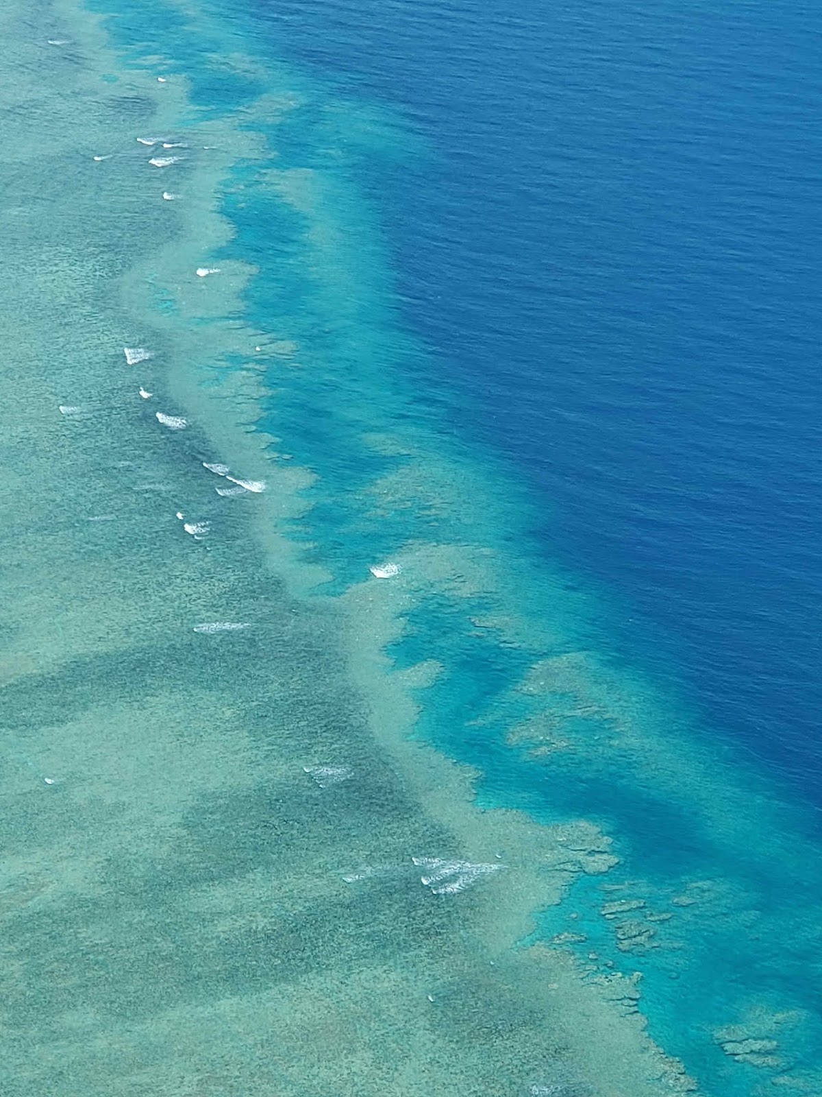
It took a full 20 minutes after leaving the bigger islands of the Whitsundays behind to reach the outer edge of the reef, where the ocean depth falls from 60 metres to 150 metres in a sheer drop. The views at the edge were just spectacular!


On the way back we had a better view of the Whitsunday Islands, as there had been some low clouds and rain squalls around when we flew out.

This little island is called Heart Reef for obvious reasons

This is probably a research facility, with a helipad on the roof. There's
a lot of work being done to determine the effect global
warming is having on the reef.


Our pilot flew a direct line back to the airport – too bad nobody told him to swerve a little in one direction or the other, because he flew right over Crystal Serenity. Larry had the best shot:


Once we landed, deplaned and reboarded the mini-bus, we got a view of some of the local wildlife. There are no kangaroos in this part of Australia, but there are many of their smaller cousins, the wallabies. This guy was watching us the same way we were watching him:


We were leaving Airlie Beach fairly early, so we didn’t spend much time in town, but we had a nice view of the ship on the tender ride back:


And again, another lovely sunset as we sailed around the islands. It was cloudy, like the evening before, but not quite as interesting.


Although the full moon, a supermoon because of its proximity to Earth, had risen the evening before, we didn't see it then. Here’s the closest we could get. It was clouding over again, so we took an early photo, just after the sun set.


Now we were heading for Cairns, which is the biggest tourist destination for visiting the Great Barrier Reef. In order to get us there safely, we did have a Reef Pilot on board. It was never mentioned, but we did see him in Marketplace at breakfast a few times, wearing his work shirt that identified the Australia Reef Pilots Association. At least we knew we would have excellent guidance to Cairns and beyond.